E-Governance
How Digital Maps Help Police Find Crime Spots
Discover the way Digital Maps Help Police identify hotspots and improve response times using modern data visualization and predictive mapping technology.
How Digital Maps Help Police Find Crime Spots
Information dictates the safety of a neighborhood before the first siren sounds. The era of the dusty ledger and the manual file has transitioned into new methods beyond the basement registry.
Today, Digital Maps Help Police by transforming raw data into a visual guide for tactical deployment. This change represents a major shift in how security is managed across the federation.
The traditional method of marking a paper map with a red pen has given way to dynamic screens. Each incident recorded becomes a coordinate that tells a story of the street.
The Old Ledger and the Visual Screen

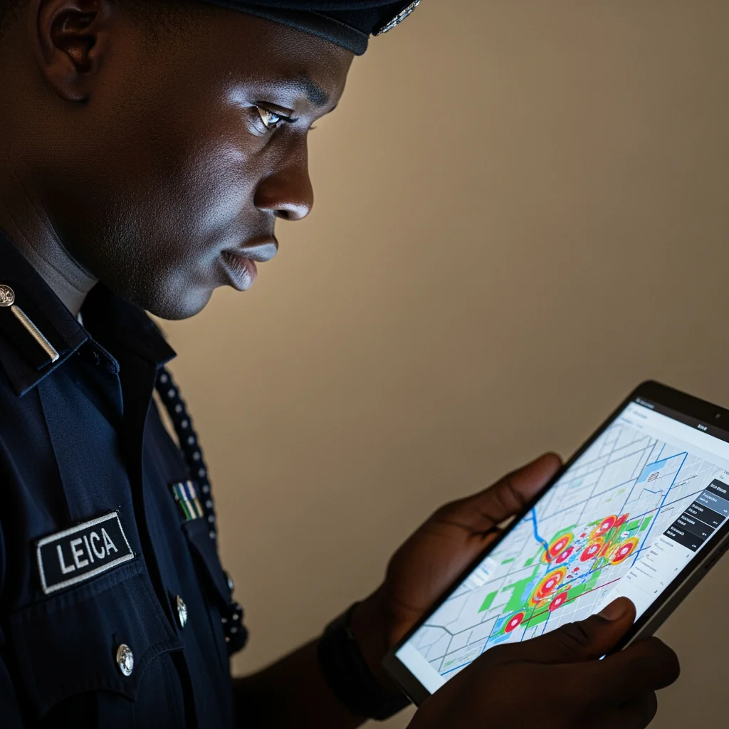
Now, the speed of data transmission has enhanced the traditional methods of information sharing. When Digital Maps Help Police, they provide a view of the city that no single observer could possess.
This visual layer allows the command center to identify where incidents cluster with precision. Reasoning replaces guesswork when the screen shows exactly where resources should go.
Expansion of security coverage is possible because the software tracks the history of each location. Statistics show that departments utilizing Geographic Information Systems have seen response times drop by as much as twenty percent.
The total volume of data processed ensures that patterns emerge from the available information. Expecting a manual file to move during a public holiday has always been a limitation of physical systems.
The digital bridge connects the street and the office by ensuring that field reports are visible in real time. This connection allows for a more responsive approach to security.
Patterns in the Rain: Predictive Power
Modern security relies on the ability to anticipate where an event might occur. Since Digital Maps Help Police, the focus has shifted from reacting to incidents to preventing them before they happen.
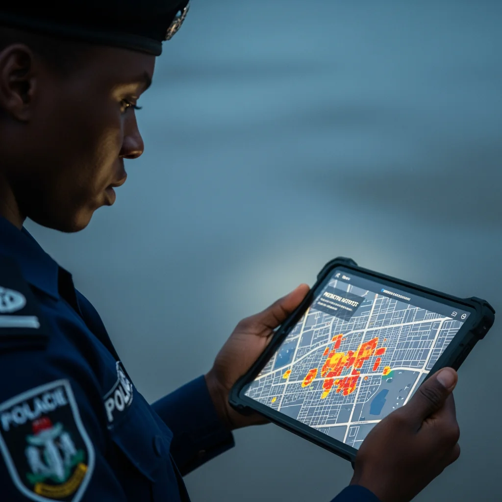
By analyzing the time and location of previous incidents, the system identifies hotspots with accuracy. This method uses historical data to project future patterns.
A particular neighborhood might show increased activity during certain hours. The organization of patrols can then be adjusted to provide a presence when it is needed.
“The police are the public and the public are the police; the police being only members of the public who are paid to give full-time attention to duties which are incumbent on every citizen in the interests of community welfare and existence.” — Sir Robert Peel
Precision in deployment ensures that resources are used where they yield the most progress. The heavy smell of old paper in a basement registry is a memory for many modern officers.
They now rely on tablets and dashboards that update as fast as the network allows. This digital bridge provides a solution to the challenge of resource allocation.
Regardless of the size of the city, the software handles the complexity of the grid. Each data point acts as a guide for the next tactical decision.
The Yield of Precision and Community Trust
Transparency in operations builds a foundation of trust between the force and the people. When Digital Maps Help Police, the data can be shared with community leaders to explain why certain areas receive more attention.
This open communication ensures that the public understands the reasoning behind patrol patterns. The visual nature of the data makes it easy for individuals to see the progress being made.
In a world where information is often hidden, the map provides a visible record of activity. The transparency offered by these tools facilitates a better relationship with the community.
Security expansion is a continuous process that relies on the quality of information. A messenger may still lean against a wall in some offices, but the data has already moved past him.
The expansion of these digital tools across the federation is a sign of progress. By focusing on the results of each patrol, the system ensures that the safety of the public continues.
The use of technology reflects the commitment to a safer and more organized society. As long as Digital Maps Help Police, the street will always have a connection to the office.
Modern Tools for a Safer Space
Professional advisors recognize that the organization of data is an important asset of a modern force. The internet provides a platform for these maps to exist and function.
Each officer who uses these tools contributes to the collective intelligence of the entire system. The result of this technology is found in the lives protected and the peace maintained.
Security is a requirement for the expansion of business and social activity. With the right tools, the force can provide the safety that the public requires.
The transition to digital systems represents progress in efficiency and precision. The traditional methods of government work are being enhanced as the digital bridge grows stronger.
Digital Maps Help Police find crime spots by making the patterns of the city visible to those who need to see them. This evolution ensures that the future of security is guided by facts and data.
The street is no longer a mystery when it is viewed through a digital map. Peace exists where information and action meet.
Rural Women Empowerment in Nigeria: Health Micro-Grants in Abia

Real Estate Tax in Nigeria: The 2026 Clarity Imperative

Medical Emergency in Nigeria: The Arithmetic of Survival

Housing Deficit Widens as Nigeria’s Urban Population Surges

WHO Red List Nigeria: Healthcare System Implications

Diaspora Health Impact Initiative 2026: NIDCOM’s Global-Local Bridge

Infrastructure Vandalism in Nigeria: Cross River and the NSCDC

Insecurity in Kwara in Nigeria: The 2026 Data

The Civil Servant with Ten Names and One Salary: Ghost Workers in Nigeria Exposed

INEC 2027 Timetable and What It Means for Political Parties: Full Breakdown of Dates and Deadlines

Comedy Industry in Nigeria and Its Economic Contribution: How Laughter Became Big Business

Why Rent in Ikoyi and Banana Island Can Cost N180 Million Per Year: Verified Prices and Market Reality

Internet Sovereignty: Why Some Countries Want Their Own Separate Internet

How One Misplaced Dot Broke a Bank Login Page

The Untold Story Of The Nigerian Who Helped Build Global Internet Systems

Nigerian Hackers: The Global Fraud Story and Its Fallout

Forgotten Satellites Defy Silence, Beaming Signals for Decades

Do Not Allow Your Digital Store to Shut Down: The Exact Dates That Kill Websites

The “Village People” Aren’t Blocking Your Sales; Your Bad SEO Is.

The Business That Died because the Owner Refused to “Go Beyond.”

Why Are You Hiding Your Business From People With Money?

How Digital Maps Help Police Find Crime Spots

Why Criminal Gangs Target Base Transceiver Stations

Entertainment as the Next Hope for Nigeria After Oil: What the Numbers Really Show
 Edutech Portal4 weeks ago
Internet Sovereignty: Why Some Countries Want Their Own Separate Internet
- Digital Hustle4 weeks ago
How One Misplaced Dot Broke a Bank Login Page
- Edutech Portal4 weeks ago
The Untold Story Of The Nigerian Who Helped Build Global Internet Systems
- Edutech Portal4 weeks ago
Nigerian Hackers: The Global Fraud Story and Its Fallout
- Edutech Portal4 weeks ago
Forgotten Satellites Defy Silence, Beaming Signals for Decades
- Edutech Portal4 weeks ago
Do Not Allow Your Digital Store to Shut Down: The Exact Dates That Kill Websites
- Edutech Portal4 weeks ago
The “Village People” Aren’t Blocking Your Sales; Your Bad SEO Is.
- Edutech Portal4 weeks ago
The Business That Died because the Owner Refused to “Go Beyond.”